Homestead Bay and the Battle for Queenstown’s Future
By Webfit News Desk
Published: December 12, 2025
As summer settles over Lake Wakatipu and the Remarkables cast long evening shadows across the basin, Queenstown finds itself confronting a defining moment.
Not a flood or a fire.
Not another record tourist season.
But a planning decision that may shape the district for generations.
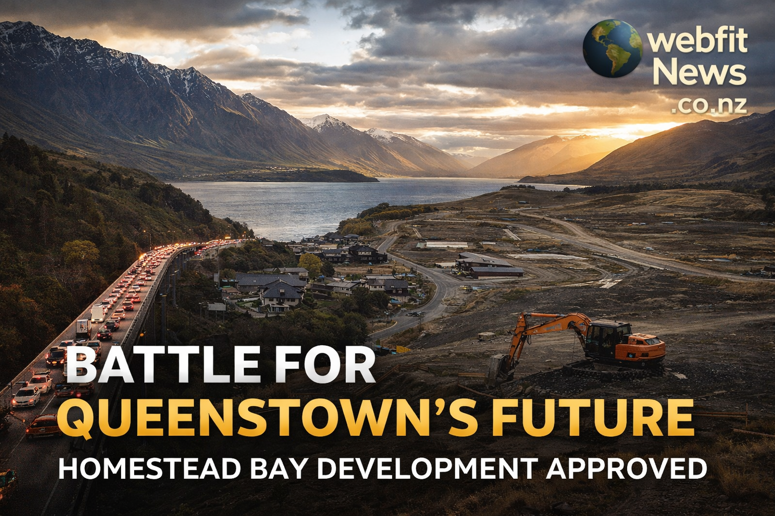
At the southern edge of Jack’s Point, on 205 hectares of Coneburn Flats known as Homestead Bay, a proposal to build what amounts to a new town has been largely approved under the Government’s Fast-track Approvals Act. The draft decision, released on December 17, has sent shockwaves through the Queenstown Lakes District, crystallising long-held fears about infrastructure, liveability, and who ultimately decides the region’s future.
This is not just a dispute over houses. It is a clash between the central government’s urgency and local physical limits.
A Region at a Breaking Point
Queenstown’s Southern Corridor has transformed at speed. What was once high-country farmland has, over two decades, become a linear chain of large subdivisions, stretching from Frankton through Hanley’s Farm and Jack’s Point, now pressing south toward the Remarkables.
The population in this corridor has surged by more than 260 percent in five years, funnelled almost entirely through one fragile artery: State Highway 6 and the Kawarau Falls Bridge.
That bridge has become more than infrastructure. It is a symbol of constraint.
And Homestead Bay sits squarely on the wrong side of it.
The Fast-Track Moment
Homestead Bay was placed directly into Schedule 2 of the Fast-track Approvals Act 2024, elevating it above the usual council-led planning process. Decision-making was removed from the Queenstown Lakes District Council and handed to an independent Expert Panel appointed in Wellington.
The logic was clear. Housing supply is a national priority. Fast delivery matters.
But so do consequences.
The Panel’s draft decision largely endorses the development, allowing it to proceed subject to conditions. In doing so, it signals a new era where infrastructure sequencing, once a cornerstone of local planning, takes a back seat to housing delivery.
For Queenstown, the implications are profound.
The Developer’s Case
The applicant, RCL Homestead Bay Ltd, is no stranger to the district. Its parent company, RCL Group, delivered Hanley’s Farm, now home to thousands.
RCL’s argument was blunt and politically effective.
Queenstown, they said, suffers from “creative inertia”. Council processes are slow. Housing demand is massive. Without continuity of development, contractors leave, capacity is lost, and prices climb further.
They pointed to a database of 6,000 would-be buyers, framing Homestead Bay as not speculative, but inevitable.
The central government listened.
A Question of Scale
Publicly, Homestead Bay has been promoted as a development of up to 2,800 homes. That number helped establish its “regional significance”.
Yet the fine print tells a more cautious story.
The application immediately seeks consent for 1,438 dwellings, with the remainder parked in future “super-lots” intended for higher-density housing over 15 to 20 years.
Critics argue this staging softens scrutiny. The full traffic and infrastructure load is acknowledged in principle, but only partially engineered in practice.
Once approved, the pathway is difficult to reverse.
The Bridge That Defines the Debate
Everything in Queenstown eventually comes back to the bridge.
Traffic modelling presented during the process shows the Kawarau Falls Bridge already operating close to capacity during peak hours. Council evidence suggests that 600 to 900 additional homes south of the bridge would consume the remaining buffer.
Homestead Bay alone proposes several times that.
RCL’s defence was legally sound if politically uncomfortable. The bridge, they argued, is a public asset. It already struggles. A single developer cannot be required to fix a historic deficit.
The Expert Panel agreed.
No requirement was imposed to fund a second crossing or major corridor upgrade. The cost of congestion is effectively socialised.
For residents, the message was stark. Growth will continue. Relief is uncertain.
Public Transport and the Promise of Shift
Much was made of future public transport, cycling, and walking.
On paper, the Southern Corridor Structure Plan imagines a less car-dependent future. In reality, safe, continuous, and grade-separated cycling routes remain aspirational. Bus services are constrained by the same congestion they aim to solve.
Without a funded transit spine, density risks becoming concentration, not transformation.
As one local submission put it, transport that is not safe enough for a child will not be chosen by an adult.
Wastewater: The Invisible Flashpoint
Less visible, but equally contentious, is wastewater.
RCL proposed two options. Connection to the council system, or a private on-site treatment and land disposal scheme.
Council opposed the private option, citing long-term risk and accountability. Residents and environmental experts raised concerns about nitrogen loading, groundwater seepage, and proximity to Lake Wakatipu.
The Expert Panel approved both.
In practical terms, this grants the developer leverage. Connection may proceed, but the private option remains a live fallback, unsettling for those who fear environmental shortcuts in an alpine catchment.
Ngāi Tahu and the Cultural Landscape
The Southern Corridor is not an empty canvas.
Ngāi Tahu, through Kā Rūnaka, engaged deeply in the process. Their Cultural Impact Assessment identified wetland loss, mauri degradation risks, and wastewater concerns as serious issues.
While they did not oppose the project outright, they secured co-management and monitoring conditions. It was a pragmatic outcome, not an endorsement.
Some losses, including several natural wetlands, are permanent.
Community Resistance: More Than NIMBYism
Opposition from Jack’s Point residents has been dismissed by some as resistance to change.
But the deeper concern is not growth itself. It is how growth occurs, and whether the promises made to earlier communities still mean anything.
Residents argue they bought into a vision of open space, careful sequencing, and amenity. Homestead Bay, they say, breaks that compact.
Behind the technical arguments lies a quieter anxiety: that Queenstown is losing control of its own shape.
What the Decision Means
The Panel’s draft decision sets a powerful precedent.
Cumulative effects, such as corridor-wide congestion, are no longer sufficient grounds to decline fast-tracked developments. If site-specific impacts are mitigated, projects can proceed even when regional systems strain.
For Queenstown Lakes District Council, the challenge is acute. Assets will be vested. Maintenance costs will follow. Funding remains uncertain.
The burden shifts, slowly but surely, to ratepayers.
A Christmas Decision with Long Shadows
The Homestead Bay approval has unlocked the final piece of the Southern Corridor.
In time, nearly 9,300 homes may line the route from Frankton to the foot of the Remarkables.
Housing supply will increase.
Traffic will worsen before it improves.
Infrastructure will chase growth rather than guide it.
Fast-tracking has delivered consent. It has not delivered bridges, buses, or pipes.
As Queenstown heads into 2026, the debate moves from whether Homestead Bay should happen to how the district lives with it.
The lesson, for the rest of New Zealand, is sobering. Planning laws can be rewritten quickly. Infrastructure cannot.
And once the corridor fills, there is no fast-track out of gridlock.
Webfit News will continue to follow this story closely, tracking the final decision, implementation conditions, and what this means for Queenstown’s future.